Are you a property professional?Get qualified leads from motivated homeowners.
Get startedExtended TwiceLong-term Owner
12 Archdale Close, Bournemouth, BH10 4EH
This 84 square metre property in Bournemouth carries an energy performance rating of D, in line with typical UK homes. It is heated by a gas central heating system and is currently listed as a private rental. Records show the property last changed hands for £160,000 back in 2009.
Property Type
Mid-Terrace House
Bedrooms
3
Floor Area
84 m²
Council Tax
Band C
Property Features
Built 1967–1975
Private Garden
Enclosed private garden
Garage
Off-street covered parking
Gas Heating
Recently Refurbished
Renovated and updated
Get started
Ready to take the next step? Find the right professionals for your property journey.
Energy Performance
EPC rating and efficiency details
Current Certificate(1 of 2)
Jun 2020
EPC Rating
A
B
C
D
D63
E
F
G
Main Heating
Gas
Main Fuel
Gas
Hot Water
Good
Windows
Average
CO2 Emissions
3.6 t/year
Tenure
Rented
Property Improvements
Changes detected from historical EPC data
Jun 2020from Feb 2009
Heating Controls
Prog + TRVsProg + Stat
Heating controls upgraded for better temperature management
Walls
Very PoorPoor
Wall insulation improved
Are we missing something? Tell us about home improvements to help adjust your valuation.
Price & History
Transactions and market trends
Estimated value
£262,000
How our AI predicts property prices · Accurate to within 10%
Automated estimate only. For an accurate valuation, consult a surveyor or estate agent.
Transaction history
+139.0%(10y)
£160,000Latest
Apr 2009£66,950
Nov 1998Source: HM Land Registry
Nearby in BH10 4EH
19 Archdale Close Bournemouth BH10 4EH
Sept 2023
£320,000
3 Archdale Close Bournemouth BH10 4EH
Apr 2018
£200,000
13 Archdale Close Bournemouth BH10 4EH
Dec 2017
£236,500
16 Archdale Close Bournemouth BH10 4EH
Oct 2014
£190,000
18 Archdale Close Bournemouth BH10 4EH
Feb 2006
£166,000
8 Archdale Close Bournemouth BH10 4EH
Jun 2004
£169,950
1 / 2
House Price Index
England+3.3%
101.6
Jan 26
UK HPI from HM Land Registry. Baseline: Jan 2015 = 100.
How This Property Compares on Archdale Close
See how this property stacks up against others nearby
Comparing to 12 other houses on this street
Price per m²
Property value per square metre of floor space
£1,905/£2,031 avg
LowerHigher
Around average
Years Held
Time since last sale — indicates ownership stability
17 years/17 years avg
ShorterLonger
Around average
EPC Rating
Government energy efficiency score (1–100)
63 (D)/66 (D) avg
Less efficientMore efficient
More efficient than only 38% of similar properties
Floor Area
Total internal floor space
84 m²/84 m² avg
SmallerLarger
Around average
CO₂ Emissions
Annual carbon output from heating, hot water & lighting
3.6 t/year/3.4 t/year avg
Higher emissionsLower emissions
Around average
Habitable Rooms
Living spaces like bedrooms & living rooms
4 rooms/4 rooms avg
FewerMore
Around average
Comparisons are based on the most recent EPC data for each property in this postcode. Only similar property types (houses) are compared.
Get alerts for BH10 4EH
New sales, price changes, and market updates in this area
Places to visit
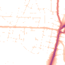
Road Noise
Average road noise levels for this postcode
Daytime
07:00 – 23:00
48.2dB
Low
Night-time
23:00 – 07:00
38.6dB
Low55 dB
60 dB
65 dB
70 dB
75 dB
80 dB
Defra Road Noise Strategic Mapping, Round 4Crime Analysis
3 months of data for Bournemouth
Total Crimes
3
Monthly Avg
1
Recent Trend
Stable
Most Common
Violence & Sexual
Crime by Category
Violence & Sexual3(100%)
Recent Incidents
Violence & Sexual
Nov 2025On or near Ross Mount Close
Violence & Sexual
Sept 2025On or near Columbia Gardens
Violence & Sexual
May 2025On or near Greaves Close
Data from Police UK • Updated monthly
Local Amenities
Schools and transport links nearby
Nearby Schools
26 within 3kmP
Kingsleigh Primary School
677m
8 mins
P
Hill View Primary School
705m
8 mins
P
St Mark's Church of England Primary School
782m
9 mins
S
Glenmoor Academy
467m
6 mins
S
Winton Academy
478m
6 mins
S
The Bourne Academy
802m
10 mins
Transport Links
30 within 3kmHendford Road
Bus Stop92m
1 min
Jubilee Gardens
Bus Stop148m
2 mins
Gorsecliff Road
Bus Stop198m
2 mins
Hibberd Way
Bus Stop332m
4 mins
Howeth Road
Bus Stop356m
4 mins
Co-Op
Bus Stop408m
5 mins
School data from Dept. for Education • Transport data from NaPTAN
Nearby Property Businesses
Local professionals serving this area
Surveyor
Anglotown
Bournemouth
RICSResidential
Surveyor
Slades
Bournemouth
RICS

Sutherland Surveyors
Bournemouth
RICSResidential
Surveyor
Slades Letting Agents
Bournemouth
RICSResidential
Surveyor
Baker Property Consultants
Bournemouth
RICS
Surveyor
Wren Letting
Bournemouth
RICS
Surveyor
Fulljames & Slade
Bournemouth
RICS
Surveyor
Bayside Building Consultancy Limited
Bournemouth
RICSResidential
Map
56 points of interest nearby
Map data from OpenStreetMap • Transport data from NaPTAN • School data from Dept. for Education • Scenic data from Beautifulplaces.ai
Frequently Asked Questions
Common questions about this property