Are you a property professional?Get qualified leads from motivated homeowners.
Get startedExtendedSold in 2025DetachedCharacter Fireplace
12 Noel Road, Bournemouth, BH10 4DP
This 80 square metre property in Bournemouth carries an energy performance rating of D, in line with typical UK homes. It is heated by a gas central heating system and is currently listed as owner-occupied. It changed hands for £395,000 last year.
Property Type
Detached Bungalow
Bedrooms
4
Floor Area
80 m²
Council Tax
Band C
Property Features
Built 1950–1966
Get started
Ready to take the next step? Find the right professionals for your property journey.
Energy Performance
EPC rating and efficiency details
Current Certificate(1 of 2)
Jan 2021
EPC Rating
A
B
C
D
D62
E
F
G
Main Heating
Gas
Main Fuel
Gas
Hot Water
Good
Windows
Average
CO2 Emissions
3.7 t/year
Tenure
Owner Occupied
Property Improvements
Changes detected from historical EPC data
Jan 2021from May 2015
EPC improved fromE53toD62
Low Energy Lighting
0%78%
More low energy lighting installed
Are we missing something? Tell us about home improvements to help adjust your valuation.
Price & History
Transactions and market trends
Estimated value
£383,000
How our AI predicts property prices · Accurate to within 10%
Automated estimate only. For an accurate valuation, consult a surveyor or estate agent.
Transaction history
+16.2%(4y)
£395,000Latest
Jul 2025£340,000
Mar 2021£286,000
Jun 2019£255,000
Nov 2015Source: HM Land Registry
Nearby in BH10 4DP
38 Noel Road Bournemouth BH10 4DP
Oct 2024
£396,000
36 Noel Road Bournemouth BH10 4DP
Jul 2024
£281,500
6 Noel Road Bournemouth BH10 4DP
Jul 2024
£425,000
30 Noel Road Bournemouth BH10 4DP
Sept 2023
£285,000
4 Noel Road Bournemouth BH10 4DP
Apr 2023
£320,000
19 Noel Road Bournemouth BH10 4DP
Mar 2023
£373,680
1 / 6
House Price Index
England+3.3%
101.6
Jan 26
UK HPI from HM Land Registry. Baseline: Jan 2015 = 100.
How This Property Compares on Noel Road
See how this property stacks up against others nearby
Comparing to 27 other houses on this street
Price per m²
Property value per square metre of floor space
£4,938/£3,646 avg
LowerHigher
Higher than all similar properties
Years Held
Time since last sale — indicates ownership stability
1 years/6 years avg
ShorterLonger
Lowest among similar properties
EPC Rating
Government energy efficiency score (1–100)
62 (D)/58 (D) avg
Less efficientMore efficient
Around average
Floor Area
Total internal floor space
80 m²/87 m² avg
SmallerLarger
Larger than only 39% of similar properties
CO₂ Emissions
Annual carbon output from heating, hot water & lighting
3.7 t/year/4.5 t/year avg
Higher emissionsLower emissions
Lower emissions than 67% of similar properties
Habitable Rooms
Living spaces like bedrooms & living rooms
5 rooms/4 rooms avg
FewerMore
More rooms than 74% of similar properties
Comparisons are based on the most recent EPC data for each property in this postcode. Only similar property types (houses) are compared.
Get alerts for BH10 4DP
New sales, price changes, and market updates in this area
Places to visit
Road Noise
Average road noise levels for this postcode
Daytime
07:00 – 23:00
48.1dB
Low
Night-time
23:00 – 07:00
38.6dB
Low55 dB
60 dB
65 dB
70 dB
75 dB
80 dB
Defra Road Noise Strategic Mapping, Round 4Crime Analysis
3 months of data for Bournemouth
Total Crimes
3
Monthly Avg
1
Recent Trend
Stable
Most Common
Violence & Sexual
Crime by Category
Violence & Sexual3(100%)
Recent Incidents
Violence & Sexual
Nov 2025On or near Ross Mount Close
Violence & Sexual
Sept 2025On or near Columbia Gardens
Violence & Sexual
May 2025On or near Greaves Close
Data from Police UK • Updated monthly
Local Amenities
Schools and transport links nearby
Nearby Schools
22 within 3kmP
St Mark's Church of England Primary School
626m
8 mins
P
Kingsleigh Primary School
712m
9 mins
P
Talbot Primary School
817m
10 mins
S
The Bourne Academy
734m
9 mins
S
Winton Academy
1.1km
13 mins
S
Glenmoor Academy
1.2km
14 mins
Transport Links
30 within 3kmActon Road
Bus Stop72m
1 min
Kingsbere Avenue
Bus Stop137m
2 mins
Liberal Club
Bus Stop264m
3 mins
Columbia Road
Bus Stop269m
3 mins
Turbary Park Centre
Bus Stop276m
3 mins
Hood Crescent
Bus Stop327m
4 mins
School data from Dept. for Education • Transport data from NaPTAN
Nearby Property Businesses
Local professionals serving this area
Surveyor
Anglotown
Bournemouth
RICSResidential
Surveyor
Slades
Bournemouth
RICS

Sutherland Surveyors
Bournemouth
RICSResidential
Surveyor
Slades Letting Agents
Bournemouth
RICSResidential
Surveyor
Baker Property Consultants
Bournemouth
RICS
Surveyor
Wren Letting
Bournemouth
RICS
Surveyor
Fulljames & Slade
Bournemouth
RICS
Surveyor
Bayside Building Consultancy Limited
Bournemouth
RICSResidential
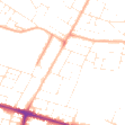
Map
52 points of interest nearby
Map data from OpenStreetMap • Transport data from NaPTAN • School data from Dept. for Education • Scenic data from Beautifulplaces.ai
Frequently Asked Questions
Common questions about this property